Camping on Bear Island, NC

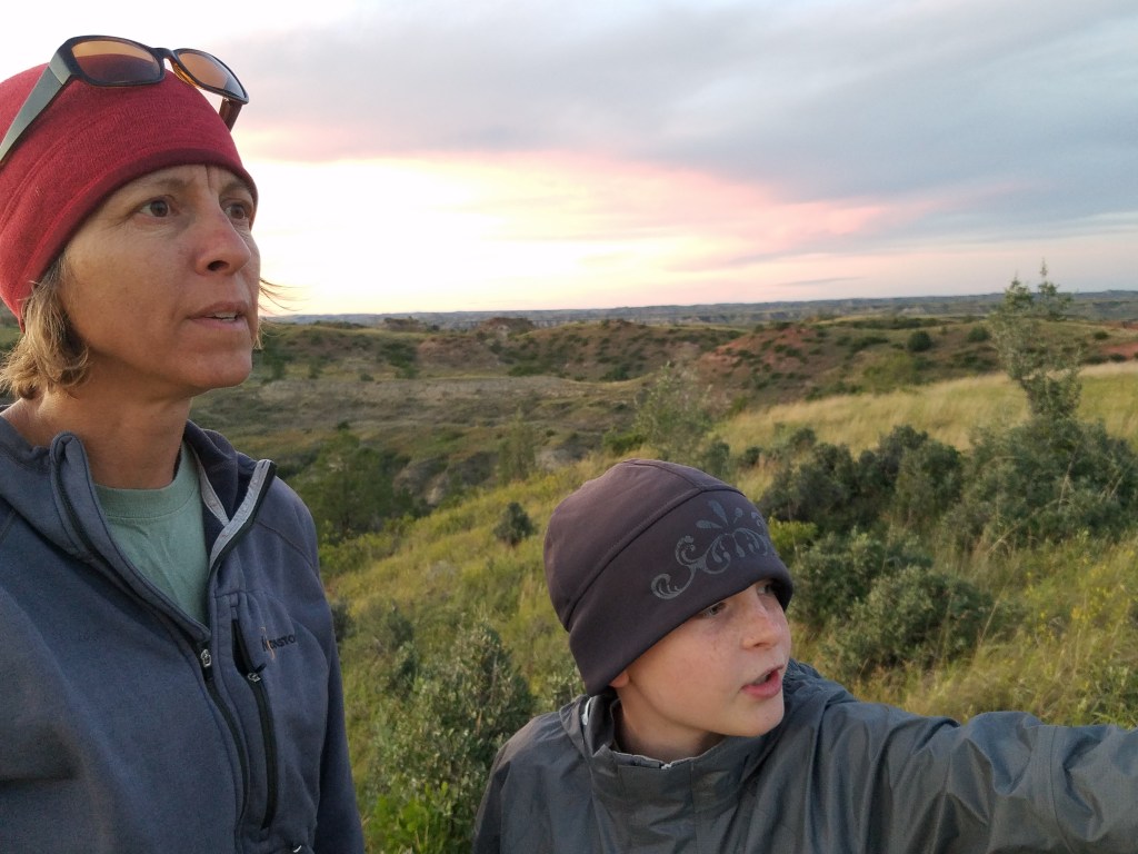
by Eliot and Quincy Larsen

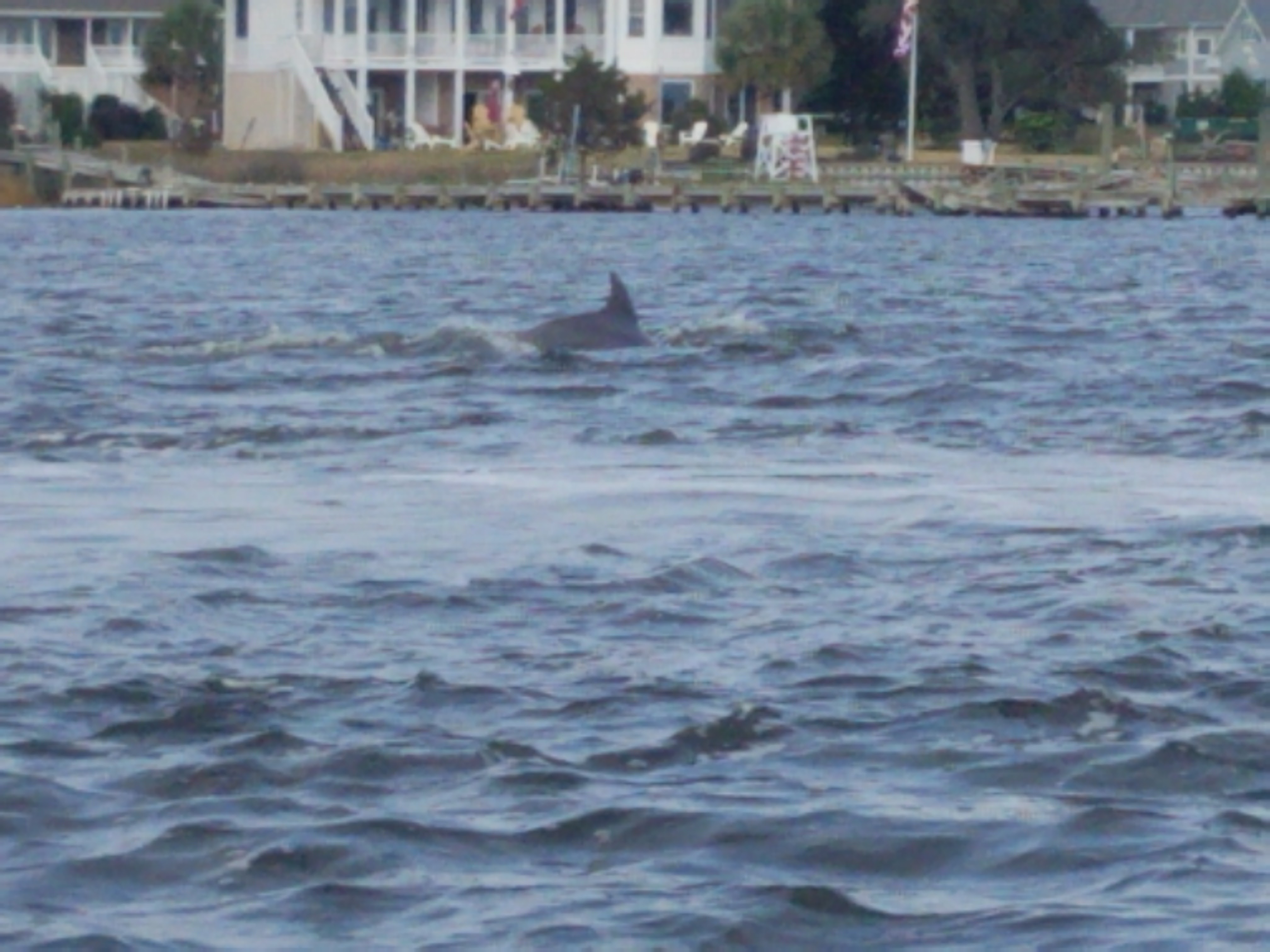
We took a trip to Bear Island. No, there were not any bears on the island. We were going to go out on kayaks, but instead we got someone to take us out on a boat, for cheaper that what we were going to pay for the kayaks. We got to see dolphins on the way out. In my opinion dolphins look really glassy and almost fake. It was really cool to see them jumping in and out of the water. Quincy managed a shot of one.

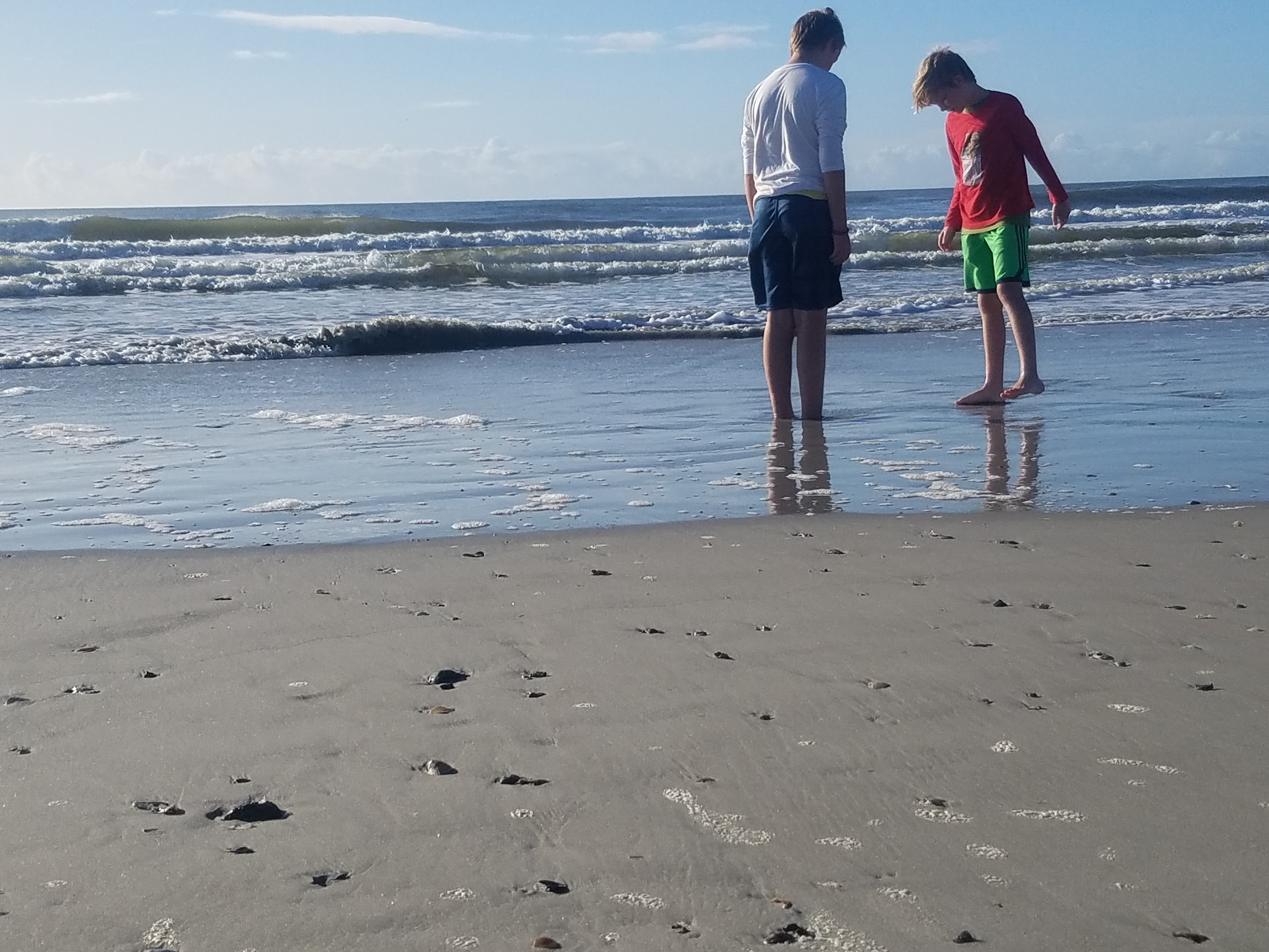
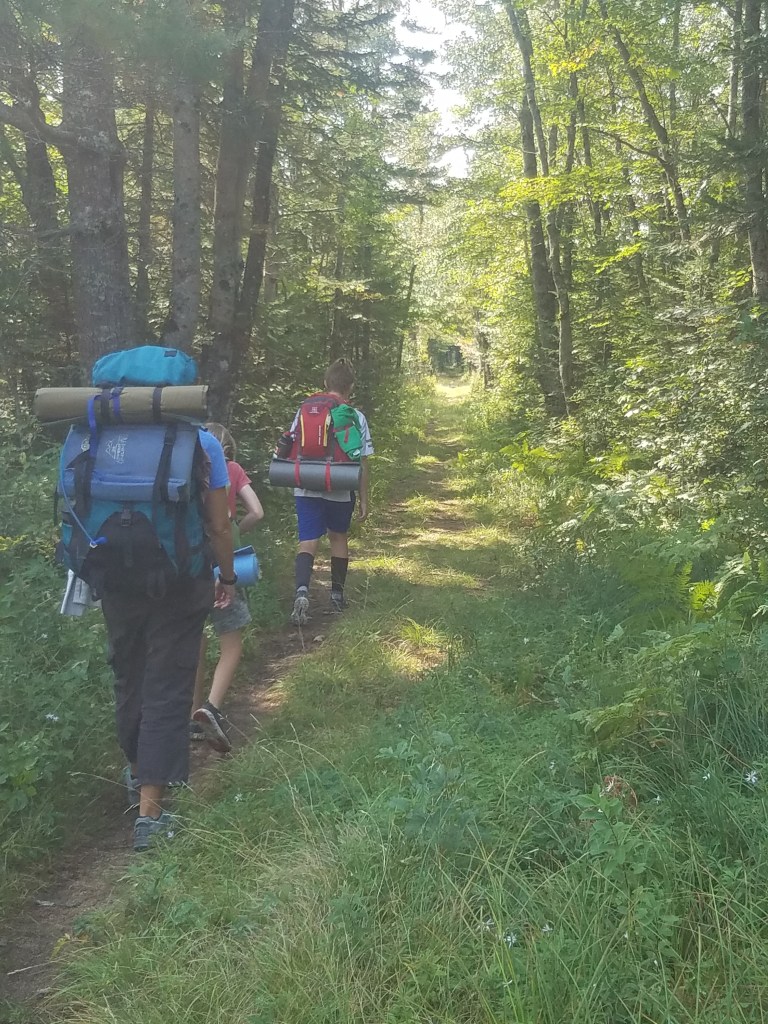
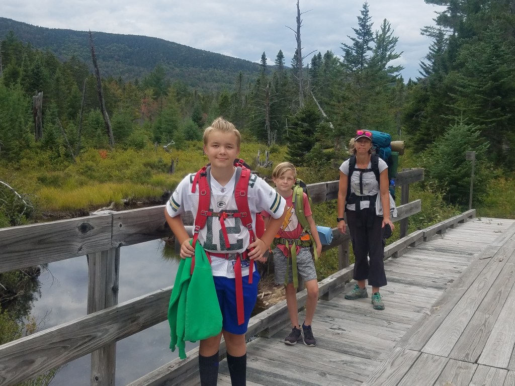
After we had gotten dropped off it was time to hike out to our campsite, on the other side of the island. When we got to the campsite we set up our tent and then got ready to go in the water. It was so much fun swimming in the waves that just kept crashing on us over and over. I was getting a bit cold and so was Quincy so we got dried off and then it was getting close to dinner time.


Our dad started making dinner and then went to sit on the beach while Quincy and I decided to start wrestling in the sand and getting sand all over ourselves. Our dad joked saying that he should’ve brought another tent with him so he didn’t have to sleep in a lot of sand. In the end of that day we gave up trying to get all of the sand off of ourselves.

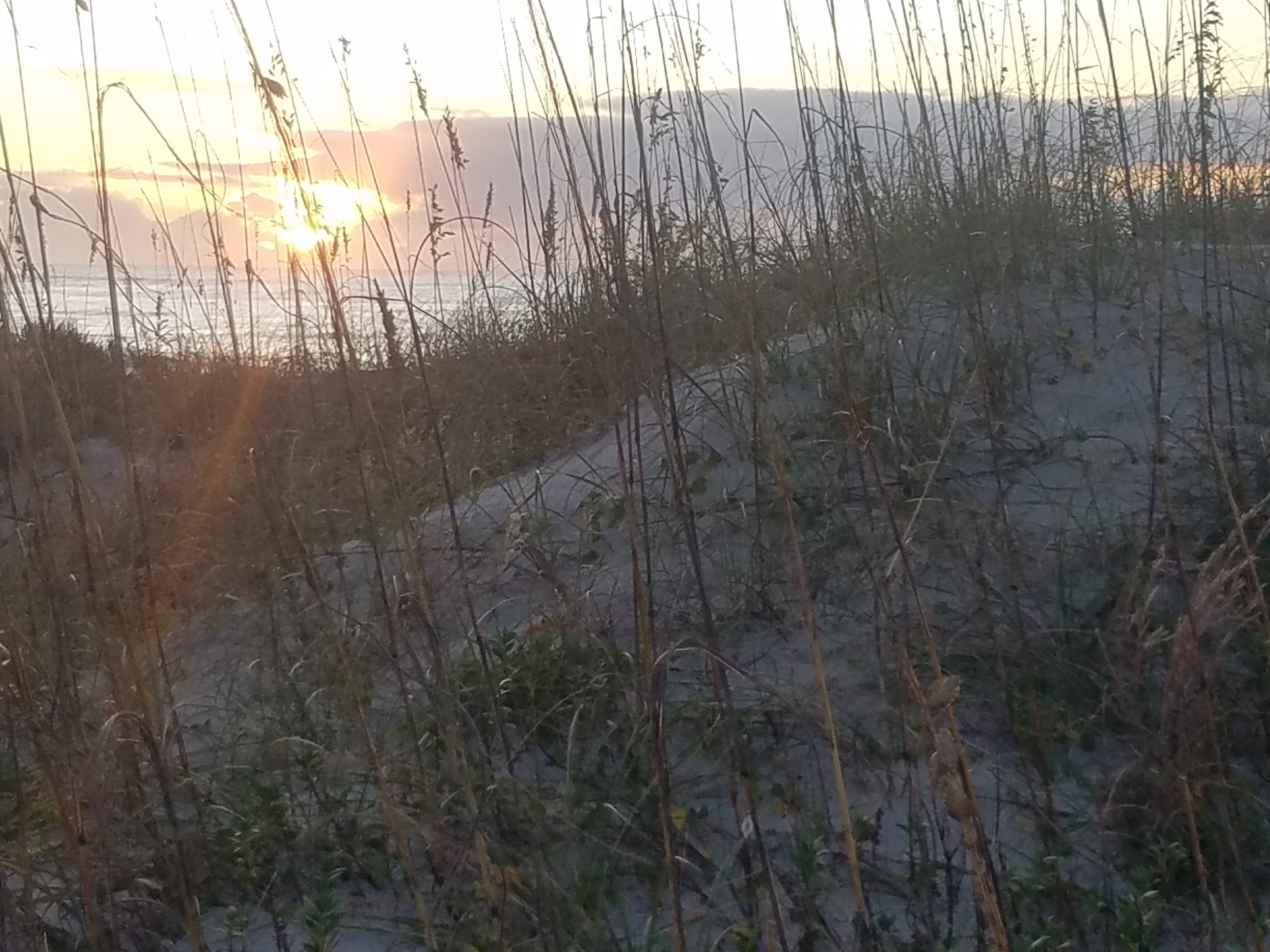
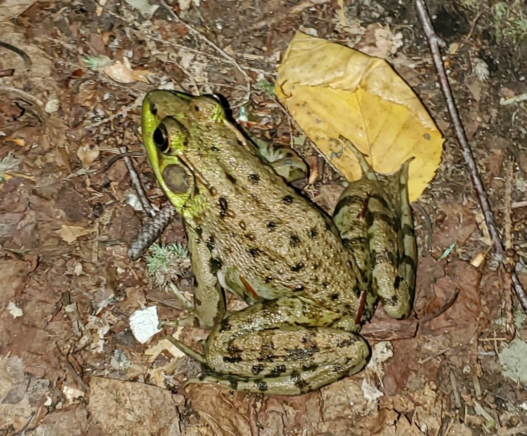
That evening we went out exploring.

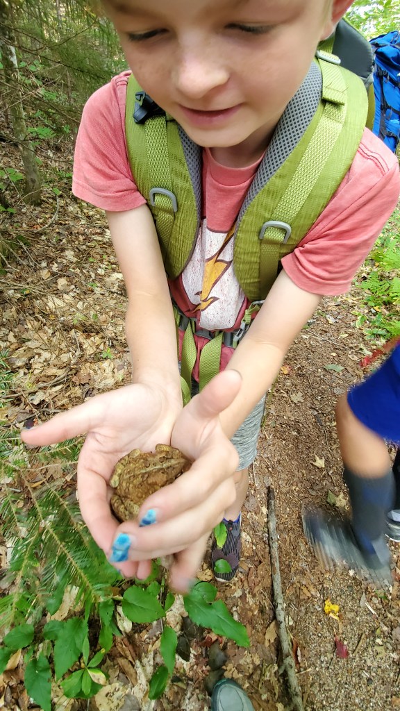
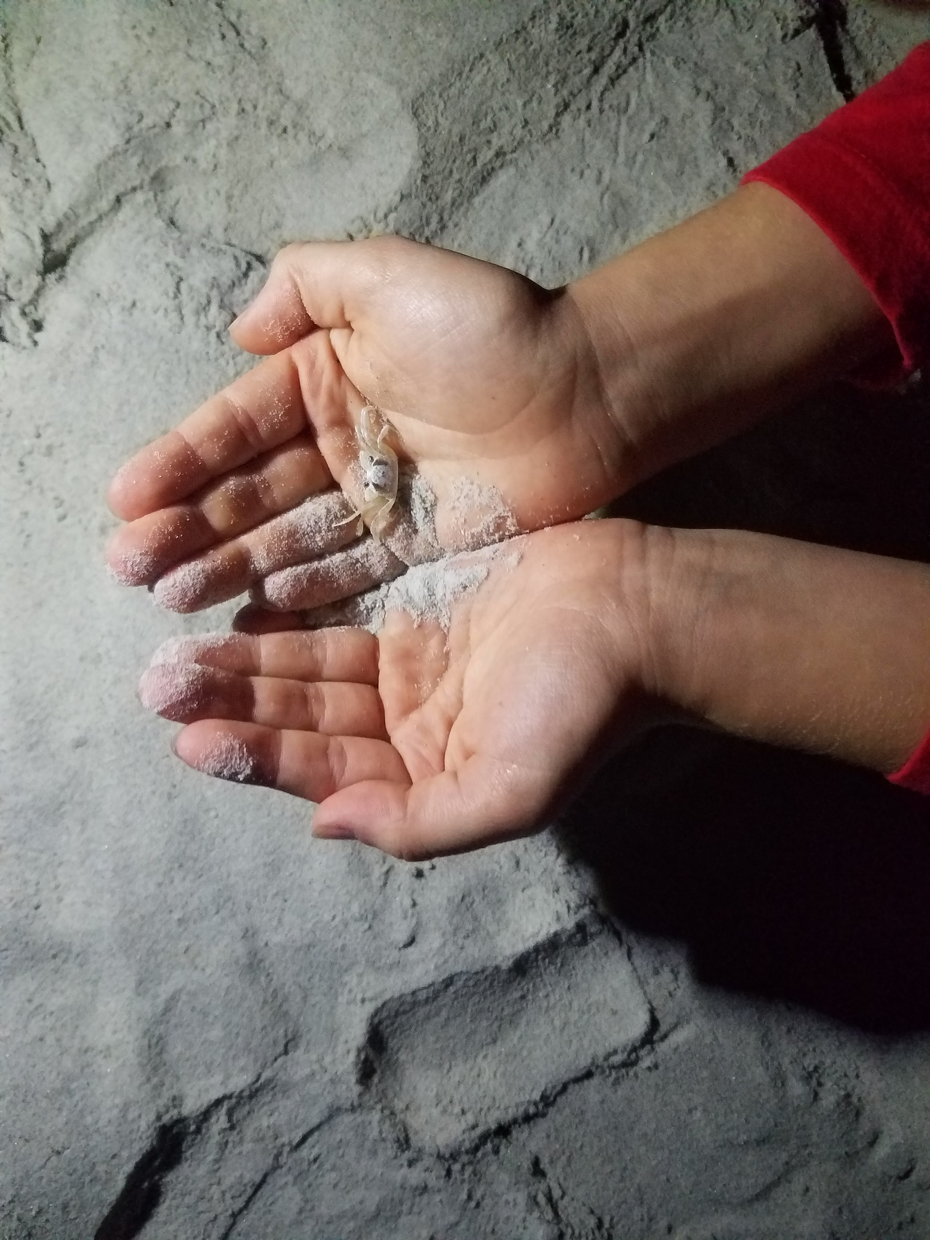
We saw lots of crabby pattys AKA crabs. Quincy was so fond of finding all of these crabs. A lot of them were so small and cute, and didn’t pinch too much.

We are walking back to the boat were we will get picked up from the island. We didn’t find any crabs on the way back but we did find some jelly fish and a horseshoe crab. The beach was so fun. There were so many shells at the top of the island you could not see the sand. Quincy found a sand dollar which he thought was a sea biscuit.

After a decent night’s sleep we got up and had some oatmeal for breakfast and then Quincy wanted to go swimming again. This was at like 9:00 am and he was very persistent about it. We got very cold very quickly. After drying off and packing up we started walking back along the beach. There were little shower things that I used to wash my feet off before we started the last half of the trek back. After we got on the boat back we took the faster root back and saw another ship wreck that was a lot bigger and looked like someone’s personal yacht that had hit something too shallow. We got back and my dad paid for the person who took us out on the island. That was our stay at Bear Island, North Carolina.


Hagley Museum

By Eliot Larsen and Quincy Larsen

Today we went to a place called the Hagley museum and the DuPont family property. There were many things that were about the 19th century (1800-1899) the main part of the “outdoor museum” was a gun powder factory located right on the edge of the Brandywine creek. The black powder was ground up in a room with three foot walls on the side and 6 foot walls on the back. If it exploded it would shoot out into the water and the roof would fly off of the top of the buildings into the creek. 

Water would turn the gears to produce power to then turn eight ton wheels to grind the different ingredients to make the black powder. The different ingredients are the black willow for charcoal, potassium nitrate “salt peter”, and sulfur. Those make the black powder. After they grind it up it is sent to get tested if it is a good batch. Only one gram of black powder was used for it to be tested.

The other way they make the black powder is with steam powered engines. The engines are fire powered and have a water chamber after the water chamber is the steam chamber that builds up pressure and can easily push a lot of weight with ease. we saw a lot of machines that look like they are churning butter with the spinning rotation. That makes it very easy to grind it into black powder especially if you are right next to a creek. 

NYC

By Eliot Larsen

We all went to NYC after we had been at our aunt’s for a couple days. We woke up on the 21st of September at 6:00 AM and headed to the Amtrak train station. After we got there we found a spot on the train and Quincy and I tried to fall back to sleep. When the train stopped everyone got off and we went from Pennsylvania Station all the way down to where we could faintly see the Statue of Liberty. After that it was about time to go to the 9/11 memorial and museum. We paid to go into the museum but you can go to where the actual twin towers were and there is an infinity pool flowing into the ground. Inside it is very sad and deep in detail about how it happened and when it happened. Also it shows some vehicles that were damaged from that day inside the museum. After the memorial we went to a nice little park/outdoor seating right outside the museum and memorial. After the subway ride back to our hotel everyone was done for the day.

Empire State building

The second day was the day that we did a later start and went into the Hell’s Kitchen area, Rockefeller Plaza and Times Square. We first went to Rockefeller Plaza and went to the Lego store there. After, we went to the Nintendo world store (which was Quincy’s favorite place we went to). After all of that it was time for lunch. We went to a Bareburger in the Hell’s Kitchen area. I had a burger and Quincy had some Gluten Free chicken tenders (Chickey Tendeys as Quincy would call them). Our parents both got different salads. French fries were a need as well when we were there. Once we ate lunch we then headed to Times Square and went to the Hershey’s and M&M stores. 

The third and final (full day). We took the subway that was right outside of our hotel room to the end of the line where we then took the Staten Island ferry to Staten Island. We hung out there for about an hour and I got a pretzel for me and a frozen lemonade for Quincy. We got back on the ferry and saw the Statue of Liberty a lot better than from Manhattan. We started back up towards our hotel while sightseeing and heading to Kesty’s. It is known for having Gluten Free anything on the menu. When we called we then found out that we had passed their new location. At this point everyone was hungry and just wanted to get back to the hotel. We headed back to our room and our dad looked for a pizza place near by. He found one decently close and ran to go pick it up

Frogs and Toads in the White Mountains, New Hampshire

By Quincy

Our back packing trip was a lot longer than we thought. But in the end we got to sleep in a lean-to shelter at Sawyer’s Pond.

I saw a bunch of Frogs and Toads that you’ll learn about in this essay.

Frogs have much longer legs than a toad. Frogs have smooth skin and toads have thick skin. Frogs’ skin is covered in mucus. Toads lay their eggs in long stands and frogs lay their eggs in clumps like a bunch of grapes. Frogs need to live near a body of water while toads can live in dryer climates.

The American toad is mainly nocturnal, but it can come out in the day time. It is most active time when it is moist and humid. In the winter it will burrow deep into the ground to hibernate all winter. It has a vibrating mating call that can last up to 30 seconds.

This is the Fowler’s toad. It has a high-pitched scream. They can be mistaken for a herd of sheep calling at night. It will make a long series of hops while an American toad makes fewer longer hops.

I’m glad that we got to do this hike and find all these Frogs and Toads.

Black Elk Peak

South Dakota conjures up a few iconic images. The Badlands. Mt. Rushmore. Ehm…tall mountains? (To be clear, for flatlanders, even Mt. Rushmore may qualify as the nose-bleed section. And yes, we did do the obligatory imitation of the dynamite-carved rock sculpture.

(L to R) Mama Larshop posing (perfect hair currently) as George, Eliot as TJ (maybe a little too angled/eagerly on Mr. Washington’s shoulder in this pose?), Quincy as a more thoughtfully-angled Teddy, and Papa Larshop (as the only facial-haired option in the group standing in for Old Abe).

For the unfamiliar, the highest point in South Dakota might feel unworthy of a true peak-bagger. But at a 7 mile round trip hike featuring over 1500′ of elevation gain, an incredible view from the Fire Lookout tower that used to be staffed to watch for wildfires in the area, including around the Mt. Rushmore area, and plenty of flora and fauna along the way, we think it qualifies as a ‘real hike’!

Black Elk Peak, visible along the skyline, the fire-tower structure in the mid-left field of view, between a few pines.

Located in Custer State Park, we’d bagged one of the last camp-sites available by taking advantage of the call-in features in the park. If an ADA-accessible site hasn’t been reserved by day-of, they’ll let it go to an able-bodied party. Good tip for the fly-by-the-seat-of-your-pants planners we’ve been so far in response to the pandemic. We’d called earlier, right at 8:00 a.m. from Wyoming near Devil’s Tower the night before, only to discover 1.) we’d had bad information from an outdated website–the call in started at 7:00am, not 8:00, and 2.) because S.D.’s call in center was based in Central Time (even though Western S. Dakota observes Mountain time), it was already 9:00am and every available site was reserved. The wheel-chair accessible campsite was actually lovely, in no small part due to how flat the campsite was with its nicely concrete flat poured area–we chuckle still at some of the places we’ve already camped, having to position random rocks and chunks of wood to level the camper so the fridge works, etc…

We digress. Custer State Park is worth another visit if you’ve ever traveled through S. Dakota and not paid the highest point a visit, or checked out the seven state parks in the system. Heck, it even features a mini-Devil’s Tower feature…visible in the first photo earlier in the post.

We started our hike late in the day–too late for a real summit hike if serious weather was threatening. But since only COVID-19 is the storm we’re constantly waiting to roll in on us, it was the perfect time to begin. We cheered the other groups dutifully wearing masks, but since we were several weeks pre-Sturgis-rally at the time, case loads were pretty low and precious few were practicing any semblance of social distancing.

The fire tower was pretty impressive at the summit. Fully staffed for many years to watch for wildfires sparking, usually after lightning strikes. The jagged peaks reminded us of the Rockies. Still accustomed to Utah and Wyoming elevations, we found the hike pretty easy overall.

Workers helped create a cistern for water storage, (presumably from rain water?) and must have had plenty of time on their hands, creating the steps Mama Larshop, Quincy and Eliot are visible in in the picture.

Crazy rooftop-of-the-world structure built, in the days when discovering a fire early could mean saving towns and lives. On our descent in the waning hours of the day, abundant wildlife surprised us along the trail, including deer, various birds, frogs, none of which we’d encountered along the way up when there were still too many descending hikers for our taste. We even ventured into a few raspberry patches to sample some of the wild vegetation.

As we approached the pretty lake at the trailhead, the stunning scenery and the isolation of our hike in a fairly popular area became clear–we were truly lucky to have such abundant opportunities to soak in these wild experiences as we journey from state to state.

A Cherry on Top

Spoonbridge and Cherry. Claes Odenburg and Coosje van Bruggen. We didn’t realize the sculpture is also a fountain until we got close.

We found Honest A’s Auto shop in downtown Minneapolis, and dropped the truck off to get the AC repaired. A perfect opportunity to explore the city on our bikes! The outdoor Minneapolis Sculpture Garden made Quincy’s list of things to do in Minnesota, and it’s an impressive, expansive place. The cherry on a spoon fountain, was not what drew Quincy in to say ‘we have to go there’ however. Rather, it was another garden-variety-larger-than-life object in the form of a bright blue chicken.

Hahn/Cock, by Katharina Fritsch. This big bird made Quincy’s bucket list for the year.

Less than 2 miles from our car-care drop-off, the sculpture garden immersed us in art to interpret for a good hour and a half before we reminded ourselves we had an entire city, er twin cities! to explore.

The Basilica of St. Mary we’d planned to visit was closed due to the pandemic. Here’s a photo of one of the doors. Too bad we weren’t able to enter.

A few miles East we crossed over the Mighty Mississippi yet again. Our bridge across gave us stunning views of the first Lock and Dam along the waterway. (A tiny piece of it visible to the far right of the photo below.) Also noteworthy, the stone archway bridge is the only one along the entire Mississippi River. We meandered around the St. Paul side of the river, and biked back across along the stone bridge, which is closed to vehicles.

We worked our way back through downtown, this time stuck on the sunny side of every street. We were making our way towards the heart of the civil unrest following the George Floyd killing. Heartfelt murals, homemade signs, and burned and even now leveled buildings greeted us in increased number as we grew closer to the heartache of the epicenter.

An abandoned K-mart parking lot, turned into a canvas and soapbox.

A few of the many, many murals we saw on our ride…

Streets are still blocked off in every direction from 38th and Chicago.

Adequately contextualizing his death is well beyond what we could possibly convey in a brief post. The memorial is sobering, provocative, and testament to how numb we’ve grown as a society to the news of an ‘unarmed African-American man who died while he was being detained by police.‘ One of the most difficult and powerful pieces to the memorial was a block-long list of Americans who have been killed in recent years. Eliot and I slowly walked the street reading each name. Will this finally awaken the conscience of the country that Black Lives Matter? Seeing peaceful protests across the country makes this moment feel like one in which lasting change is possible.

Soon after leaving the memorial we got word the truck was ready. We pedaled back to where we’d started the day. Back to the same location, but changed. A quick stop at Minnehaha Falls, and Henry Wadsworth Longfellow’s house nearby lightened our mood and cooled us off a bit (as did the now fixed AC!).

The Headwaters

The Milk. Missouri. Yellowstone. Platte. Niobrara. The Republican. The Canadian. The Red. These and dozens of other rivers all empty into the Mississippi River Basin, the largest and longest in North America. We’ve crossed waters that flow into this river from many different states already, and will continue to do so throughout the fall, winter and spring. According to the EPA, water from 31 U.S. states and 2 Canadian provinces drain out to the gulf of Mexico.

By Shannon1 – Own work, CC BY-SA 4.0, https://commons.wikimedia.org/w/index.php?curid=47308146

So after our brief foray into Canada vis-à-vis the International Peace Garden, it was on our list of adventures as we started meandering south again. Meandering is something the Mississippi does well up here, moving north out of Lake Itasca, then wandering eastward for a while, then south, then west before finally settling on a southerly direction. Small wonder then that it took multiple attempts prior to explorer Henry Rowe Schoolcraft and chief Ozawindib’s party to trace it’s source in 1832.

Lake Itasca is a large lake. ‘Why isn’t the headwaters that little stream that feeds into Lake Itasca?’ ‘Why isn’t a tributary that starts in Montana, or Wyoming, or Saskatchewan the “true” headwaters?’ We discussed as many many others do who visit. And as we’ve since crossed the Mississippi countless other times on our journey, is it ever possible to step in the same river twice?

The Mississippi’s mighty, but it starts in Minnesota at a place that you can walk across with five steps down…” or so sang the Indigo Girls about the headwaters of the Mississippi. The iconic little foot bridge is just as described in the song, but had several people idling about upon it. How to enjoy the location during a pandemic? Wade out into the reeds and cattails on Lake Itasca, away from everyone else.

The ‘musketoes’ back in the Schoolcraft/Ozawindib days might have been pretty terrible, but we weren’t particularly bothered by any.

Lake Itasca State Park is a pretty impressive, and large park. Later we took a lovely bike path several miles along the lake, stopping here and there along the way to see the sights. At Preacher’s Grove we stopped to hike around a bit. Here we finally found my constant terror: the ‘voracious, long-billed, dyspeptic muketoes’ as Schoolcraft described them 188 years prior.

After a brief look around, we hiked back to our bikes, and returned finally to our rig after four or so hours of our own, tamer exploration. The cool waters of Lake Itasca had long since dried on our bodies and we were fully ready to turn the AC back on high (as evidenced perhaps by Quincy’s face above?) We hopped back into the car and turned the air on, only to be greeted by a horrible racket–the blower motor was going. We chanced running it a few minutes anyway, the vibrations so great you could feel them even through the backseat. An unwelcome massage, given at any moment it could fly off, taking a chunk out of the radiator, slicing off a belt, or wreaking other havoc on the engine block. Late on a Sunday afternoon, in rural northern Minnesota, we were unlikely to find any solution today. We finally found a campsite for the night in the City of Menahga. Hopefully we can get the AC fixed soon.

Theodore Roosevelt N.P.

We stopped in at the Painted Canyon visitor center in the South Unit of Teddy Roosevelt Nat’l Park to pick up a backcountry permit. The ranger at the desk discouraged us from going, saying the clay soil of the trails would be slick as could be, and we’d be picking up inches of soil on the soles of our shoes. And with COVID, they weren’t issuing permits at the desk, we’d have to do it online. Online turned out to be a phone number to call, but we persevered, and got the permit, minutes before closing time. We struck out on the Big Plateau trail from Peaceful Valley Ranch, just after 5:00pm. The going was indeed sticky and slippery in spots. We came to the river crossing. Little Missouri River–a brown flowing the color of an iced coffee. The water wasn’t too cold. At about 100′ across, not too bad to ford. I felt my first real sense of freedom as we crossed, leaving behind another family who’d hiked down to the river on the over side.

Papa Larshop carrying the boys' packs, as they follow behind. Only just over knee-deep in a few places.
Papa Larshop carrying the boys’ packs, as they follow behind. Only just over knee-deep in a few places.

It was just us and the wilderness now. A solid 1/2 mile slog up a tough canyon brought us to a vast mesa known as the Big Plateau. Prairie dogs, as far as the eye could see. We hiked up a gentle sloping meadow, the prairie dogs sounding the rolling alarm announcing our presence to their neighbors as we went. We set up camp at the very top edge of the plateau, with a commanding view of the Little Missouri valley all around.

Eliot, Mama Larshop finish setting up the boys' tent, while Quincy comes over to check on dinner's progress.
Eliot, Mama Larshop finish setting up the boys’ tent, while Quincy comes over to check on dinner’s progress.

After supper we further explored the area. As the sun set, the big sky grew orange and pink hues in nearly every direction. Just before dusk, we spotted a brown, hulking figure slowing moving towards us from the bottom of the plateau. As it moved closer, we could see what it was coming towards us. A huge-headed bull bison.

The bison working his way up the plateau towards our camp. Mind you, our tents are pitched about ten yards from the edge of a steep ravine. Nowhere for us to retreat to higher ground.
The bison(the brownish dot up and left from the boys’ tent), working his way up the plateau towards our camp. Mind you, our tents are pitched on a relatively narrow spit of land, about ten yards from the edge of a steep ravine. Nowhere for us to retreat to higher ground.

He moved steadily towards us, occasionally pausing to consider what he was approaching. Now, a bison can outrun you (speeds upwards of 25 miles/hr), out jump you (I’ve seen one clear a four foot fence on Antelope Island in Utah like he was just clicking up his heels), and as most adult males weigh upwards of 1,000 lbs, outweighed the four of us together two-and-a-half fold).

Quincy and Mama Larshop discussing the approaching bison.

A quarter mile away. 200 yards away. 100 yards away. 50 yards away. We put ourselves behind one of our tents, recognizing it offered scant protection. Luckily, after one last, long pause, he shrugged us off, and headed off up the trail. About 30 minutes later, another bison followed suit, and in the grey twilight we watched as he followed his counterpart.

Coyotes treated us to a chorus of their wild song off and on throughout the night, awakening me about 4:30am so I could poke my head out of the tent to see the NEOWISE comet still streaking towards the horizon. An even larger chorus of songbirds announced the approaching dawn. Mist shrouded valleys retreated with the sun’s warming rays, and we roused ourselves for a quick breakfast and to hit the trails.

We meandered up and down the North Dakota badlands, encountering further prairie dog towns. I kept reciting my own variations on the ee cummings poem… (apologies, ee!)

“Anyone lived in a prairie dog town

(with up so floating many bells down)…”

as we went.

A prairie dog, on his haunches. Ready to sound the alarm, or just dive into his hole.
Ready to sound the alarm, or just dive into his hole.

We saw pronghorn, big horn sheep, another bison on the way out. A few rabbits, including this guy, who obliged and posed for a photo:

Overall, our first back-packing adventure was a real success–no one lost a shoe in the mud, no one got trampled by bison, and my big horror–mosquitoes, were in mercifully short supply. We’re really starting to hit our stride as travelers. North Dakota’s motto ‘liberty and union, now and forever, one and inseparable’ rings out as we’ll head east to the Capital, Bismarck, before heading north to the International Peace Garden along the longest unguarded border in the world–between the U.S. and Canada. Once we cross over, we’ll have officially earned our nickname: Larshopswithoutborders.

Who We Are

We’re the Larshops! We have the once-in-a-lifetime opportunity to travel the country while Dad is pursing his PhD, Mom is able to step away from her job, and Eliot and Quincy are in 8th and 5th grade–both U.S. History years in school, so what better time for us to travel the country?

There’s that old adage about going nowhere fast. During the pandemic we probably all feel that way. Well, as a family we’ve decided to do the opposite. We’re planning to go just about everywhere. Slow. We’ve embarked on a year long cross-country adventure to visit off-the-beaten-path sites across the United States to see what makes each state great.

Why we’re doing it.

The U.S. remains the best place on earth to grow up. From our National Parks to City Parks, from grand metropolitan libraries to quaint cafes and coffee shops; these United States of ours offer glimpses into both our collective pasts, and our potential futures. We’ve committed to investing a year of our lives as a family to explore and experiment, to interview and inquire, and help grow community a bit along the way. We’ll grow closer as a family, see the country, and gain a deeper appreciation for what makes these United States so special…individually and as a collective whole. We hope you’ll tag along for the full adventure! 

You come too.

We’ll be posting updates as we figure out the details of our journey, adding content for each state. Have a favorite haunt you think we should visit? Drop us a line. Never been to a state we just went through, and have a question about something cool we’ve experienced? Post away–we’ll get back to you as soon as we can. Catch up with us enroute!